
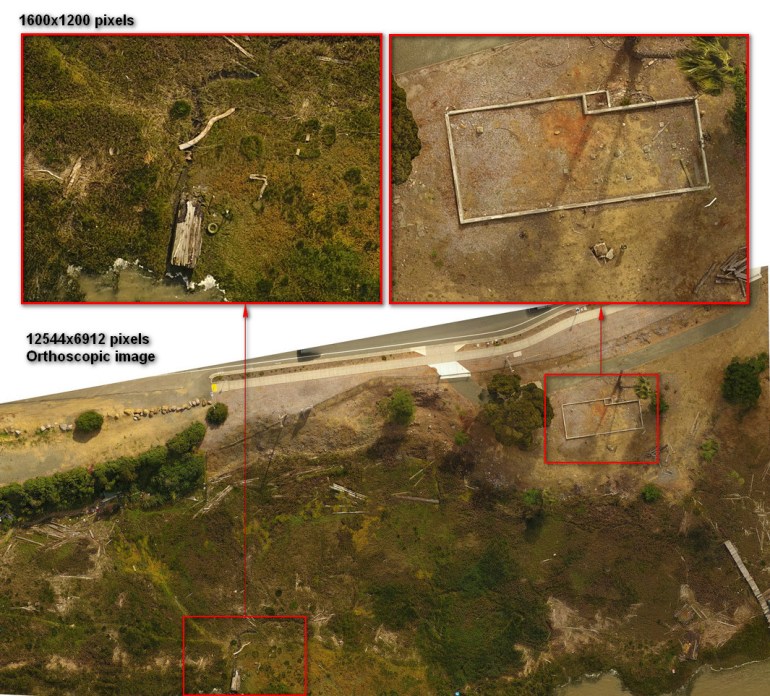
Rugged terrain? We specialize in search & rescue custom 2D & 3D mapping, as well as aerial videography and aerial photography. We have a proven method for quickly mapping large areas. We work with law enforcement and the Coast Guard creating high resolution maps. Our experience makes it easier for you to get things done.
Almost any size area can be mapped, and emergency services are available. You can expect to see even small items on the ground with good detail, such as a pack of cigarettes. We use geotagging in our 2D, and 3D orthomosaic images so you can quickly locate things. Undulating topography and rugged terrain are not a barrier. These images can easily be downloaded and imported into google earth. They can also be viewed on a smartphone, tablet or other devices and discretely shared anywhere via the web.
Please feel free to look through my portfolio and contact me here.


© Aerial Perfectionist. Greater Bay Area Aerial Photography & Videography.
